Historical Land-Cover Change and Land-Use Conversions Global Dataset
Land-Cover
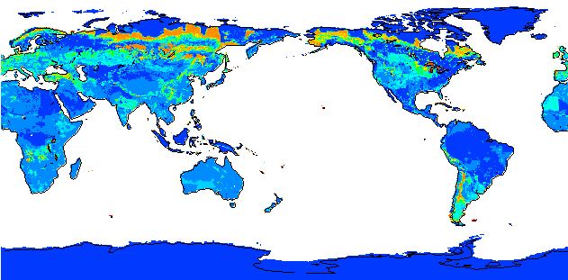 Sample view of data
A set of three estimates of land-cover types and annual transformations of land use are provided on a global 0.5 x0.5 degree lat/lon grid at annual time steps. The longest of the three estimates spans 1770-2010. The dataset presented here takes into account land-cover change due to four major land-use/management activities: (1) cropland expansion and abandonment, (2) pastureland expansion and abandonment, (3) urbanization, and (4) secondary forest regrowth due to wood harvest. Due to uncertainties associated with estimating historical agricultural (crops and pastures) land use, the study uses three widely accepted global reconstruction of cropland and pastureland in combination with common wood harvest and urban land data set to provide three distinct estimates of historical land-cover change and underlying land-use conversions. Hence, these distinct historical reconstructions offer a wide range of plausible regional estimates of uncertainty and extent to which different ecosystem have undergone changes. The three estimates use a consistent methodology, and start with a common land-cover map during pre-industrial conditions (year 1765), taking different courses as determined by the land-use/management datasets (cropland, pastureland, urbanization and wood harvest) to attain forest area distributions close to satellite estimates of forests for contemporary period. The satellite based estimates of forest area are based on MODIS sensor. All data uses the WGS84 spatial coordinate system for mapping.
- Users must cite this dataset when used as a source.
- NCEI DSI 9821_01
- gov.noaa.ncdc:C00814
C00814
| Download Data |
|
| Distribution Formats |
|
| Ordering Instructions | Contact NCEI for other distribution options and instructions. |
| Distributor | NOAA National Centers for Environmental Information
ncei.info@noaa.gov |
| Dataset Point of Contact | Customer Engagement Branch
NOAA National Centers for Environmental Information 1-828-271-4800 ncei.orders@noaa.gov |
| Dataset Point of Contact | Prasanth Meiyappan
PhD Candidate UI-UC/ATMO > Department of Atmospheric Sciences, University of Illinois at Urbana-Champaign 217-898-1947 meiyapp2@illinois.edu |
| Coverage Description | |
| Time Period | 1770-01-01 to 2010-12-31 |
| Spatial Reference System | urn:ogc:def:crs:EPSG::4326 |
| Spatial Bounding Box Coordinates |
N: 90.0
S: -90.0
E: 180.0
W: -180.0
|
| Spatial Coverage Map | |
| Dataset Information |
|
| General Documentation |
|
| Associated Resources |
|
| Publication Dates |
|
| Data Presentation Form | tableDigital
|
| Dataset Progress Status | Complete - production of the data has been completed |
| Data Update Frequency | Not planned |
| Purpose | This dataset was developed to understand the consequences of historical changes in land use and land cover for ecosystem goods and services. In particular, the data sets can be used to study how global land-cover changes have influenced climate, biogeochemical cycles, water cycle, biodiversity, etc. This data set can be used directly within spatially-explicit climate and biogeochemical models. The data are unique by providing a complete reconstruction of the past, and, in terms of details in land-cover types and methodology, are also relatively flexible to implement in other models. The dataset provides new avenues for climate models to study how uncertainties in historical land-cover change translate into uncertainties in quantifying its impacts on environmental variables of interest. |
| Dataset Citation |
|
| Cited Authors |
|
| Originators |
|
| Publishers |
|
| Theme keywords | Global Change Master Directory (GCMD) Science Keywords
|
| Data Center keywords | Global Change Master Directory (GCMD) Data Center Keywords
|
| Place keywords | Global Change Master Directory (GCMD) Location Keywords
|
| Use Constraints |
|
| Access Constraints |
|
| Fees |
|
| Processing Steps |
|
Last Modified: 2023-06-23
For questions about the information on this page, please email: ncei.info@noaa.gov